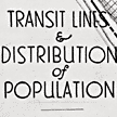
In 1927 a recreation report by a group of St. Louis landscape engineers and city planners proposed a series of roadways compatible with auto traffic and street car lines. During the same period another study was conducted on then current transit operations with suggestions offered on improving the level of service. This plate from that study shows the existing transit lines operating within the county and the distribution of population. Notes on the map indicate that each dot represents 20 persons and that one quarter mile of walking distance to transit lines was used as the basis for service.