Sacramento History Online

Historic Sacramento Photograph and Document Archive


View Large Image
Title
Official map of Sacramento Cal.
Publisher
[Chicago, G.F. Cram]
Date
[ca. 1895]
Description
1 col. lithograph ; 11 x 15 in.
Subject(s)
Summary
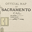
This "official" map of 1895? shows Sacramento city railways, actual and proposed. Deceptively simple in appearance, this small-sized grid of a growing town packs a big punch historically when compared to current maps lacking the sloughs, squares, parks (and even a lake!) no longer on the scene. Cemeteries and parks are colored green and bodies of water appear in blue.
Owning
Institution
Sacramento Public Library, Sacramento Room
Copyright
© Sacramento Public Library, Sacramento Room
Filing
Location
VAULT: Map drawer 2
You may refine your search results or perform a new search by returning to the search page.