Title |
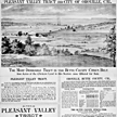
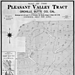
Map of the Pleasant Valley tract at Oroville |
Publisher |
San Francisco : Lith. Dakin Pub. Co. |
Date |
[1887] |
Description |
1 map ; 21 1/2 x 19 5/8 in. image on 28 1/4 x 21 1/4 in. sheet. |
Subject(s) |
Orchards--California--Butte County (13), Farming--California--Butte County (5), Real estate development--California--Oroville (2), Oroville (Calif.) (9), Butte County (Calif.) (35) Lithographs (46), Maps (139), Prints (97) |
Summary |
Map of Pleasant Valley tract comprising portions of sections 8, 9, 16, and 17 of township 19, north range 4 east, m.d.m. containing about 600 acres; surveyed by C.W. Reece. Inset: Map showing relative location of Pleasant Valley tract to city of Oroville, farm lands and orchards. Text promotes agricultural advantages of the area. |
Owning Institution |
California State Library, California History Room |
Copyright |
© California State Library, California History Room |
Call Number |
c912.B98r 1887 |
Filing Location |
MAP: BUTTE COUNTY. 1887 |
Other Formats |
Negative, nos. 27,520a (8 x 10 in. b/w, front view); 27,520b (8 x 10 in. b/w, back view); 27,520c (4 x 5 in. detail) |