Sacramento History Online

Historic Sacramento Photograph and Document Archive


Geographic Subject Search

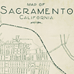
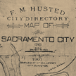
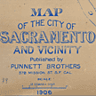
All images for Geographic Subject Sacramento (Calif.)--Maps
9 Records

Railroad map showing existing facilities. 1930. Sacramento Public Library, Sacramento Room. SPE 385.11 G671 1930 SAC

Major Street Plan - Sacramento]. 1930. Sacramento Public Library, Sacramento Room. SPE 385.11 G671 1930 SAC

Map of City of Sacramento, California. 1927. Sacramento Public Library, Sacramento Room. SPE 979.454 L487 1927 Nov SAC

Seeing Sacramento - Map]. 1927. Sacramento Public Library, Sacramento Room. SPE 979.454 L487 1927 Nov SAC

Map of Sacramento California. [ca. 1925]. Sacramento Public Library, Sacramento Room.

Sacramento City CA. from the foot of J Street, showing I, J & K Sts. with the Sierra Nevada in the distance (1849). 1968 reproduction of 1850 print. Sacramento Public Library, Sacramento Room.

City directory map of City of Sacramento. 1907. Sacramento Public Library, Sacramento Room.

Map of the city of Sacramento and vicinity. 1906. Sacramento Public Library, Sacramento Room.

Official map of Sacramento Cal.. [ca. 1895]. Sacramento Public Library, Sacramento Room.

You may refine your search results or perform a new search by returning to the search page.